
Alpine Lake Camping in Central Japan: Nagano and Yamanashi's Highland Shores
📅 2026-09-27
Why Central Japan's Alpine Lakes Are Worth the Climb
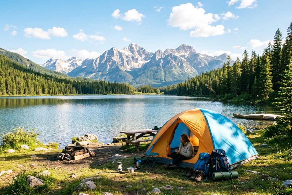
Most visitors chasing lake camping in Japan default to the Fuji Five Lakes, and for good reason — but the wider highlands of Nagano and Yamanashi hold a denser cluster of alpine lakes than almost anywhere else in the country. This is volcanic and tectonic terrain: calderas, glacially carved basins, and dammed valleys sitting between 700 and 1,900 meters, wedged among the Southern Alps, the Central Alps (Kiso range), and the Yatsugatake volcanic chain. The result is a style of camping you don't get on the coast or in the lowlands — cool nights even in August, water so clear you can see trout finning over the gravel, and mountain views that change color three times before breakfast.
This trip is for campers who want scenery without a multi-day alpine trek attached to it. You drive or bus in, park near the shore, and you're already looking at Mt. Fuji, Yatsugatake, or the Kiso range without lacing up boots. It suits families who want a lakeside base with swimming and canoeing, photographers chasing the "diamond Fuji" reflection shots at Lake Yamanaka or Kawaguchiko, and solo campers who want quiet, cold-adjacent nights that thin out the summer crowds found at sea-level campgrounds. It does not particularly suit people wanting big surf, reef diving, or groomed ski runs — this is a different register of outdoor Japan, closer to the Alps of Europe than to Okinawa's coastline, and several of these lakes (notably Suwa and the Fuji Five Lakes) carry centuries of Shinto lake-worship history, with shrines like Suwa Taisha anchoring local festivals tied directly to the water.
Historically, these highland basins were settlement backwaters until the Meiji and early Showa eras, when Karuizawa-style highland resort culture pushed westward into Nagano's lake country. Lake Nojiri became a foreign missionary summer retreat in the early 1900s, and that legacy is still visible in the lakeside cabins and international summer school that operates there today — a small but real cultural layer most guidebooks skip.
Reading the Shoreline: Camp Layouts, Water Conditions, and Which Lake Fits Your Trip
Alpine lake campsites in this region generally fall into three layouts, and picking the right one matters more than picking the right lake:
- Managed lakeside campgrounds (most of Yamanashi's Fuji Five Lakes, Lake Shirakaba in Nagano) — mowed pitches, coin showers, rental tents and canoes, RV sites, and a store on-site. Easiest for first-timers, but book weekends months out.
- Rustic national-park-adjacent sites (Lake Nojiri, Lake Aoki, parts of Lake Suwa's shoreline) — pit toilets, no showers or basic ones, first-come pitches. Better for solitude and unobstructed mountain views, worse for families with small kids.
- Cabin and glamping hybrids (increasingly common around Kawaguchiko and Yamanakako) — wooden decks over lake-facing pitches, heated cabins for shoulder-season trips, useful if you want the view without full alpine-night cold exposure.
Water conditions vary by lake type. The Fuji Five Lakes (Yamanaka, Kawaguchi, Sai, Shoji, Motosu) are spring- and snowmelt-fed, cold even in midsummer (rarely above 22°C), calm enough for canoeing and stand-up paddleboarding but too cold for casual swimming without a wetsuit. Lake Suwa, Nagano's largest, is shallower and warms more in summer, historically famous for its "Omiwatari" ice ridges that form when the lake freezes solid enough to crack and heave — a phenomenon Suwa Taisha priests have recorded and ritually interpreted for over 500 years. Lake Nojiri and Lake Aoki, further north in Nagano, sit closer to the Sea of Japan weather system, so they catch more cloud and rain than the Fuji-side lakes; check radar the night before rather than trusting a general forecast.
For the actual mountain-view payoff: Lake Yamanaka and Kawaguchiko face Mt. Fuji directly and are the most photographed for a reason, but they're also the most crowded. Lake Shoji and Lake Motosu (the smallest, cleanest of the five) give you Fuji with far fewer neighbors. On the Nagano side, Lake Shirakaba near Tateshina delivers a full panorama of the Yatsugatake range, and campers at Lake Suwa get a 360-degree bowl of the Northern, Central, and Southern Alps on a clear day — arguably the single best mountain-view lake camp in the region if you don't need Fuji specifically in frame.
Season and Access: When to Go and How to Get There from Tokyo
Season window: Late April through early November is the realistic camping season; snow closes most unheated lakeside sites from December to March, though a few operators near Kawaguchiko run winter "diamond dust" glamping for cold-hardy visitors. Late June brings the rainy season (tsuyu), which hits Nagano's northern lakes harder than the Fuji-side lakes — if you only have one window, aim for the first three weeks of July before Obon crowds hit, or mid-September to mid-October for autumn foliage reflections and thinner crowds. August is peak but also peak heat-escape season for Tokyoites, so weekend sites fill fast; midweek trips are dramatically easier to book.
From Tokyo to Yamanashi (Fuji Five Lakes): Shinjuku Station to Kawaguchiko Station via the direct JR Chuo Line limited express or the Fujikyu Railway (with a transfer at Otsuki) takes about 1 hour 50 minutes. Highway buses from Shinjuku Bus Terminal run direct to Kawaguchiko and Yamanakako in roughly 1 hour 45 minutes and are often cheaper with camping gear in tow. By car, it's about 1.5–2 hours via the Chuo Expressway from central Tokyo, with the Kawaguchiko IC putting you within 10 minutes of most lakeside campgrounds.
From Tokyo to Nagano (Suwa, Shirakaba, Nojiri, Aoki): The Hokuriku Shinkansen from Tokyo Station to Nagano Station takes about 80 minutes, useful for Lake Nojiri (roughly 40 more minutes by local train and bus) or points north. For Lake Suwa and Lake Shirakaba, the JR Chuo Line limited express (Azusa/Super Azusa) from Shinjuku to Chino or Kami-Suwa Station runs about 2.5 hours, followed by a short bus or taxi to the shore. By car, the Chuo Expressway again does the work — Suwa is about 2.5 hours from central Tokyo, Shirakaba a bit longer via local roads from the Chino IC.
A car is genuinely useful here: most lakeside campgrounds are a 10–30 minute drive from the nearest station, and gear-heavy camping trips are miserable on foot with infrequent local buses. If you're going car-free, pick campgrounds explicitly listed as "station-accessible" or budget for taxis.
Packing, Booking, and Lakeside Etiquette
Booking: Popular Yamanashi sites (Kawaguchiko, Yamanakako) open reservations online 2–3 months ahead and sell out for summer weekends almost immediately; Nagano's quieter sites (Aoki, parts of Nojiri) can often be booked 2–3 weeks out except during Obon (mid-August). Most campground booking pages are Japanese-only — a translation extension handles this fine, but call ahead if you need an English-speaking site or have dietary restrictions for on-site meals.
Gear for altitude swings: Even in August, lakeside nights at 800–1,400 meters can drop to 10–12°C, so pack a 3-season sleeping bag rather than a summer-only one, plus a warm layer for evenings. A closed-cell foam pad matters more here than on flat coastal ground — many pitches are gravel or root-laced lakeshore, not soft turf. Bring bug protection: alpine lake shorelines are notorious for evening mosquitoes and, near Nagano's forested sites, biting flies (abu) in midsummer daylight hours.
Food and fires: Direct ground fires are banned at nearly every lakeside site; use a raised fire pit or rental brazier, sold or lent at most campground offices. Many sites near Kawaguchiko and Suwa sell fresh local produce and grilled fish (particularly wakasagi, a small lake smelt netted through the ice in winter and pan-fried fresh in summer) at on-site or nearby shops — worth building a dinner around rather than hauling in all your own supplies.
Etiquette: Quiet hours (usually 10pm–6am) are enforced more strictly at Japanese campgrounds than many Western visitors expect — generators and loud groups draw complaints fast. Trash sorting is granular (burnable, plastic, cans, bottles) and campgrounds rarely provide bins for general waste; pack out what you can't sort correctly on-site. If you're near Lake Suwa during a local festival period, note that the lake and its shrine hold real ceremonial weight for residents — treat shoreline shrines and torii gates with the same respect you'd give one in a city, not as a photo backdrop.
Was this page helpful?
Your feedback helps us improve our guides